Advanced Surveying & Geospatial Solutions

From field data acquisition to engineering-ready deliverables — BTPL combines UAV, LiDAR, GNSS/RTK, photogrammetry and conventional surveying technologies for infrastructure and development projects.

Bearing Technology Private Limited (BTPL) is a Delhi-based surveying and geospatial services company, established in August 2009, that has surveyed more than 1,600 km of infrastructure corridor, mapped more than 3,350 acres and completed survey assignments in 12+ Indian states, from Kerala to Ladakh, for government, EPC and private-sector clients including NHAI, CPWD, DIMTS and Afcons.

  • UAV
  • LiDAR
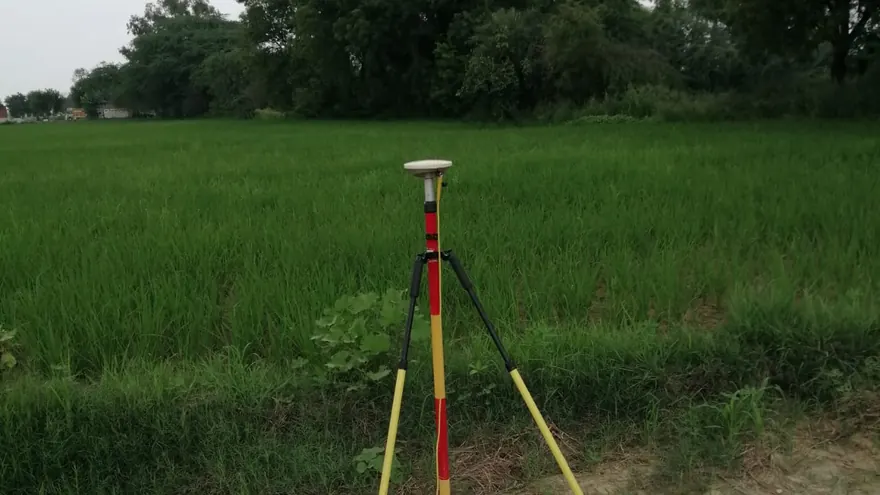
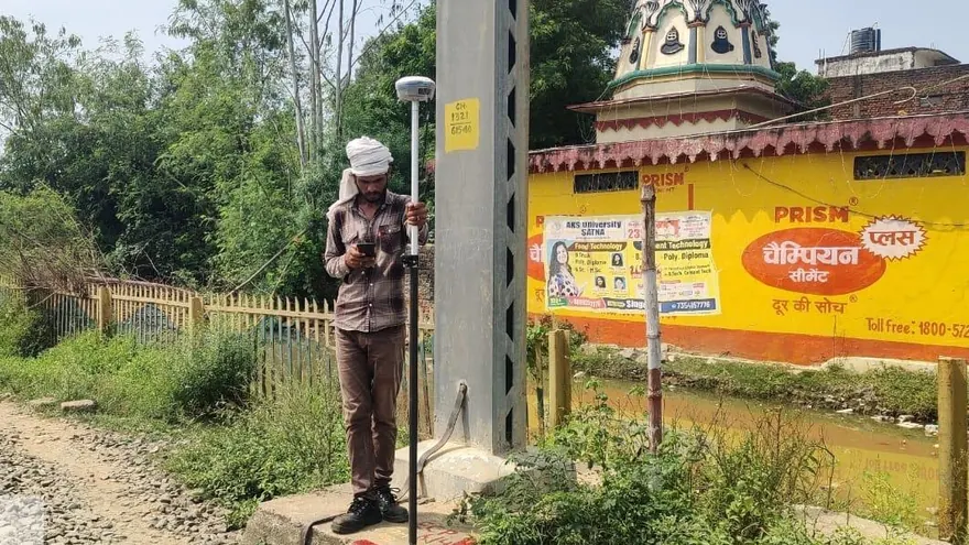
  • GNSS / RTK
  • Photogrammetry
  • Hydrography
  • CAD / GIS

Free tool — Coordinate Converter (UTM ⇄ Lat/Long)

DTM · 0.5 m 101.42102.1899.86100.94 N TOPOGRAPHICAL PLAN · 1:1000 · CONTOUR 0.5 m 01 · SITE 02 · UAV / LIDAR CAPTURE 03 · POINT CLOUD → TERRAIN 04 · CAD DELIVERABLE SITE → CAPTURE → TERRAIN → CAD
One site, four representations — how BTPL turns ground reality into engineering data.
Our Workflow

From Field to Engineering-Ready Data

Watch a survey move from the field to a finished deliverable — a single accountable workflow of acquisition, processing, analysis and delivery under one roof.

CUT/FILL ORTHODTMCADREPORT01 · CAPTUREUAV · LiDAR · GNSS02 · PROCESSPhotogrammetry · point cloud03 · ANALYSEContours · sections · volumes04 · DELIVERCAD · GIS · reportsPROCESS TIMELINE
01 — CAPTURE

Field Data Acquisition

  • UAV & Drone LiDAR
  • GNSS / RTK & DGPS
  • Total Station
  • Digital Level
  • Hydrographic systems
02 — PROCESS

Data Processing

  • Photogrammetry
  • Point-cloud processing
  • Terrain modelling
  • GIS processing
03 — ANALYSE

Engineering Analysis

  • Contours & profiles
  • Cross sections
  • Volumes
  • Spatial analysis
04 — DELIVER

Usable Deliverables

  • CAD & GIS
  • Orthomosaic · DTM · DSM
  • Point cloud
  • Drawings & reports
Core Capabilities

What BTPL Does

Ten capability groups covering the full survey and geospatial workflow — from field acquisition to subsurface investigation and engineering deliverables.

UAV / Drone Survey

High-resolution aerial mapping, orthophotos, terrain modelling and engineering survey data.

Explore Capability

Drone LiDAR Survey

Dense 3D point-cloud acquisition for terrain, corridors, infrastructure and vegetation-affected sites.

Explore Capability

GNSS / DGPS / RTK Survey

High-accuracy survey control, GCP establishment, static observations and RTK field measurements.

Explore Capability

Topographic & Engineering Survey

Detailed ground survey for infrastructure, design, construction and development projects.

Explore Capability

Hydrographic / Bathymetric Survey

Rivers, canals and reservoirs surveyed with positioning and echo-sounding technology.

Explore Capability

Corridor & Infrastructure Survey

Highway, railway, transmission line, canal and pipeline surveys for linear infrastructure.

Explore Capability

Photogrammetry & Point Cloud

Orthomosaics, terrain models, contours and classified point clouds processed in-house.

Explore Capability

CAD / GIS & Mapping

Engineering-ready CAD drawings, GIS datasets, digital maps and geospatial deliverables.

Explore Capability

GPR / Subsurface Survey

Non-destructive Ground Penetrating Radar investigation for buried utilities, structures and features.

Explore Capability

Ground Truthing & GCP Networks

DGPS validation of satellite imagery and ground control networks for mapping programmes.

Explore Capability
Proof of Work

Selected Projects

Representative BTPL assignments — what was required, how it was surveyed, and what was delivered.

View All Projects

Technology

Which survey technologies does BTPL use?

BTPL uses survey-grade mapping UAVs, drone LiDAR sensors, multi-frequency GNSS receivers for static control and RTK measurement, total stations and digital levels, and echo-sounding hydrographic systems, processed in-house — the sensor and method are selected per project, not the other way around.

Aerial Mapping

UAV mapping systems for efficient large-area data acquisition.

LiDAR Reality Capture

LiDAR systems for dense 3D measurement and terrain modelling.

GNSS Positioning

Professional GNSS/RTK technology for survey control and field observations.

Engineering Measurement

Total Stations, Digital Levels and associated field instrumentation.

Hydrographic Mapping

Positioning and echo-sounding systems for underwater terrain measurement.

Processing Capability

Photogrammetry, point-cloud, terrain and GIS processing workstations and software.

Technology & Equipment

Outputs

What deliverables does BTPL produce?

BTPL delivers orthomosaics, digital terrain and surface models, contours, classified point clouds, CAD topographical drawings, GIS data, cross sections, longitudinal profiles, volume analysis, bathymetric surfaces, KML/KMZ files and technical reports with methodology and QC records — every project ends in information engineers can use directly.

OrthomosaicGeoreferenced aerial imagery
Digital Terrain ModelBare-earth DTM surfaces
Digital Surface ModelDSM incl. structures
ContoursProject-specified intervals
3D Point CloudRaw & processed clouds
Classified LiDARGround / vegetation / structures
CAD Topographical DrawingDWG / DXF standards
GIS DataShapefile / GeoPackage / KML
Cross SectionsDesign-ready sections
Longitudinal ProfilesCorridor L-sections
Volume AnalysisCut–fill & stockpiles
Bathymetric SurfaceUnderwater terrain
KML / KMZGoogle Earth ready
Technical ReportsMethodology & QC records
Interactive

What is the difference between a DSM and a DTM?

A Digital Surface Model (DSM) records the top of everything a sensor sees — ground, vegetation, buildings and structures — while a Digital Terrain Model (DTM) is the processed bare-earth surface with vegetation and structures removed, and it is the surface engineers design on. BTPL delivers both from UAV and LiDAR campaigns. Drag the divider to compare the two. (Illustrative visual.)

148.6 132.4 bare-earth terrain with contours · DTM
DSM · surface incl. vegetation & structures
DSMDTM
Why BTPL

Built for Serious Survey Requirements

Integrated Survey Capability

Conventional and advanced survey technologies within one workflow.

Field + Processing Expertise

Data acquisition supported by professional post-processing and mapping.

Engineering-Focused Outputs

Deliverables structured for practical design, planning and project use.

Flexible Technology Selection

Survey methodology selected according to terrain, accuracy and project requirements.

Multi-Sensor Capability

GNSS, UAV, LiDAR, Total Station and hydrographic systems available where applicable.

Project-Specific Quality Control

Control and validation planned according to project requirements.

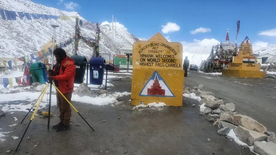
BTPL surveyor setting up GNSS at Chang La pass, Ladakh at 17,688 ft
Wherever the project is — BTPL surveys there. Control survey at Chang La pass, Ladakh · 17,688 ft.

Bearing Technology Private Limited (BTPL) was established in August 2009. Since then BTPL has surveyed more than 1,600 km of infrastructure corridor, mapped more than 3,350 acres of ground, and completed survey assignments in 12 or more Indian states, from Kerala in the south to Ladakh in the north.

2009Established (August 2009)
1,600+ kmCorridor surveyed
3,350+ acresArea mapped
12+ StatesKerala to Ladakh
Clients

Clients Served

Organisations for whom BTPL has completed survey assignments, in some cases as a sub-consultant to the party named.

Names and marks identify organisations for whom Bearing Technology Pvt. Ltd. has completed survey assignments, in some cases as a sub-consultant. All marks belong to their owners; their use here indicates completed work only, not endorsement, approval, empanelment or partnership. Rights owners may write to info@bearingtechnology.biz for removal.

Free Survey Tools

Professional Tools, Free for the Survey Community

BTPL builds and maintains a growing set of free browser-based utilities for surveyors, GIS professionals and engineers: coordinate conversion, distance and area, bearing and traverse, point-file conversion, survey units, drone GSD and flight planning, and levelling. Everything runs in your browser; your data never leaves your machine.

Coordinate Converter

UTM ⇄ Lat/Long · 24 ellipsoids incl. Everest 1830 · DD / DM / DMS · bulk CSV & Excel · KML / KMZ · PDF reports · English & हिन्दी

Single PointBulk Conversion KML / KMZPDF Report
  Built by experienced survey & geospatial professionals

Bearing Technology Pvt. Ltd.

Bearing Technology Pvt. Ltd. is a Delhi-based surveying and geospatial company established in August 2009, serving government, EPC and private-sector clients across India with field teams whose professional experience ranges from 10 to 15+ years.

About BTPL
Knowledge

Technical Resources

UTM vs Latitude/Longitude

When to use projected grid coordinates and when geographic coordinates serve better.

Read Guide

DSM vs DTM

Surface models and terrain models — what each contains and which one your project needs.

Read Guide

GNSS vs DGPS vs RTK

Positioning methods and accuracy classes explained for project planning.

Read Guide

Have a Survey or Geospatial Requirement?

Share your project location, approximate scope and required deliverables. Our team will review the requirement and discuss the appropriate survey approach.